The climate of South Greenland
Southwest Greenland has a sub to low Arctic climate, yet lies at the same latitude as southern Norway, with its temperate coastal climate warmed by the Gulf Stream. By contrast, Baffin Island in Eastern Canada, which is also located at the same latitude, has a cooler and more continentally influenced low Arctic climate. Southwest Greenland is thus a transitional region, with continental, oceanic and Alpine climatic factors, from the Gulf Stream warmed waters of the North Atlantic to the climate of northeastern Canada.
Greenland extends from lat. 59° 47' N to 83° 40' N, and offers considerable climatic variation from north to south. The country is divided into a high Arctic climate zone in northern Greenland, a low Arctic area in the largest remaining portion of Greenland, and a subarctic zone in the inner fjord areas of Southwest Greenland.
The high and low Arctic is the proper Arctic, whereas the subarctic is a transitional zone, featuring the tundra woodland that is typically found between the temperate boreal climate zone and the Arctic.
Here we will only deal with the sub and low Arctic, which is of importance for agriculture. The basis for reindeer and sheep farming is thus the relatively mild climatic conditions in the southernmost part of Greenland, with a low Arctic climate zone in coastal areas and a subarctic climatic zone (the border region between the temperate and Arctic areas) in the inner fjords. The border between low and subarctic often lies very close to an isotherm that links localities with approx. 10°C as the mean temperature in July. If we apply this rule of thumb to Greenland, then areas with approx. 10°C in July would be subarctic (or, perhaps more accurately, boreal), implying that low-lying land in the inner fjord areas of South Greenland should be classified as Arctic.
Botanist Jon Feilberg, however, divides the areas south of 63° latitude into climatic zones based on flora geography and the presence of willow and birch thickets:
1. The outermost zone near the sea (hyper-oceanic, low Arctic):
no thickets
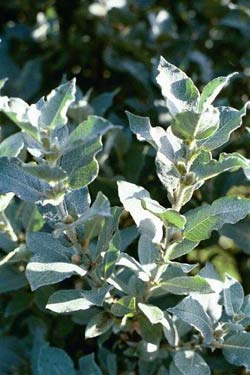
2. The outermost fjord areas (oceanic, low Arctic): willow thickets
3. Intermediate fjord (sub-oceanic, sub-/low Arctic):
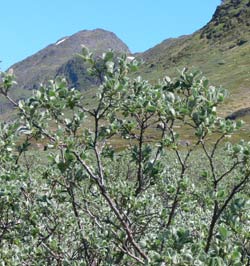
birch and willow thickets
Annual precipitation of approx. 600 to 800 mm; approx. 7 months,
mean temperature above freezing. Birch thicket woodlands
(inner fjord areas, Cape Farewell-Arsuk)
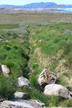
This last area is by far the most important zone for agriculture!
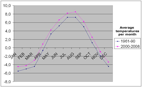
Summer temperatures vary to a fair degree in Southwest Greenland. There is a relatively large difference between stations located inland (Narsarsuaq) and coastal areas, including the outer fjord areas (Upernaviarsuk/Nanortalik/Alluitsup Paa). Winter temperatures drop to approx. -7°C during the coldest months in the inner fjord areas.
The outer fjord areas have a warmer winter climate with lows of approx. 5°-6°C. Summer temperatures in the warmest month reach approx.
7°-8°C in the outer fjord areas of South Greenland (Upernaviarsuk),
rising toward the end of the fjords to 10°-11°C (Narsarsuaq).
During normal years, grazing areas enjoy growth periods with average temperatures of 5°C from late May/early June to mid/late September, with a longer growing season in the inner fjords in comparison to the outer areas. For further information on climatic norms in Qaqortoq and Nanortalik, please see www.dmi.dk.